CULTURAL AND SPORT CENTRE IN ROME

CULTURAL AND SPORT CENTRE IN ROME
Description
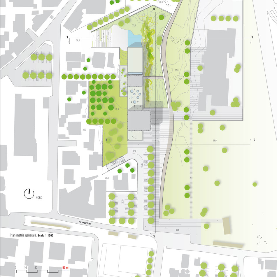
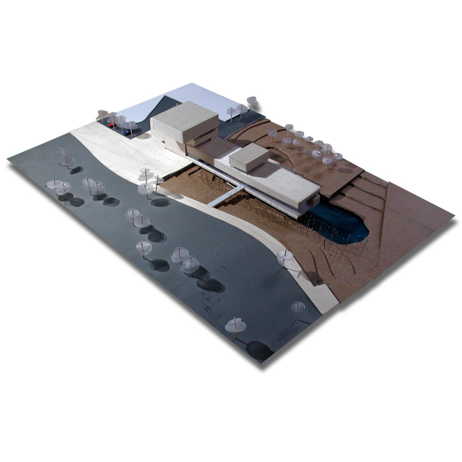
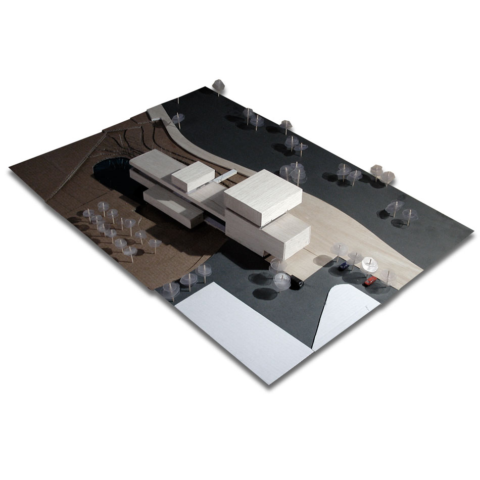
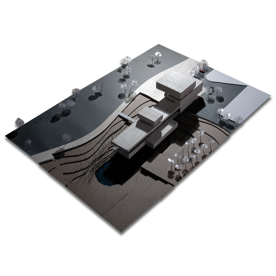
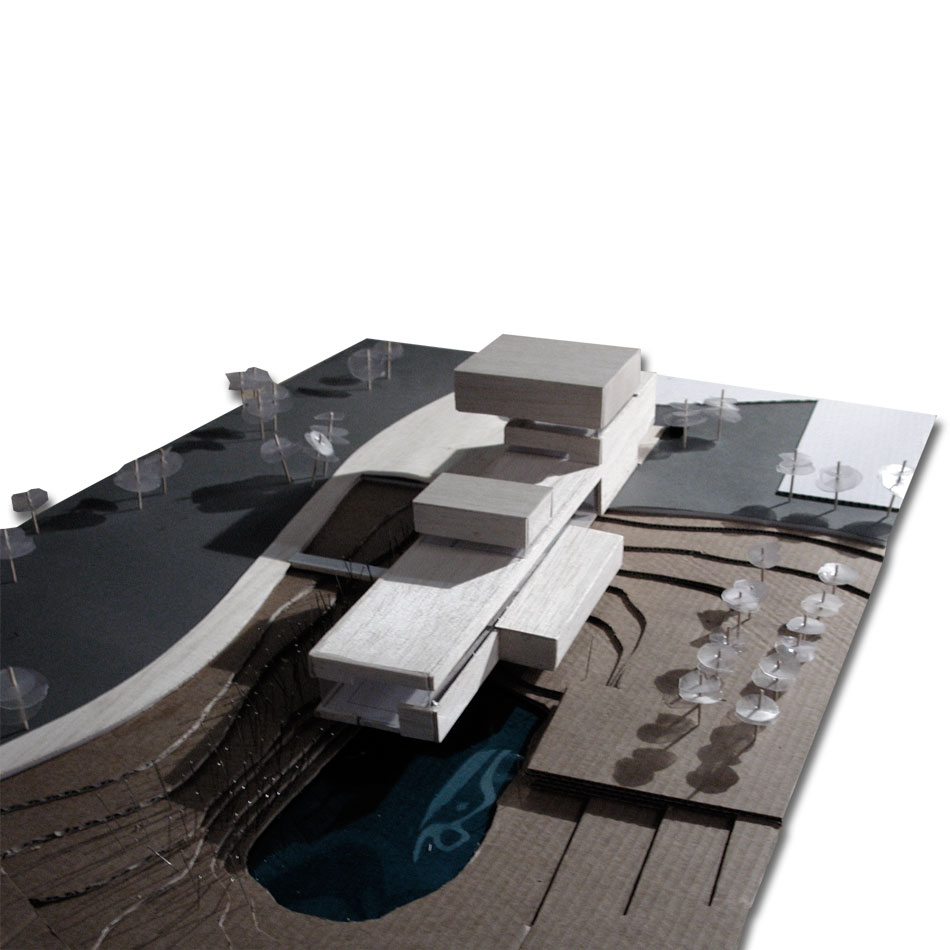
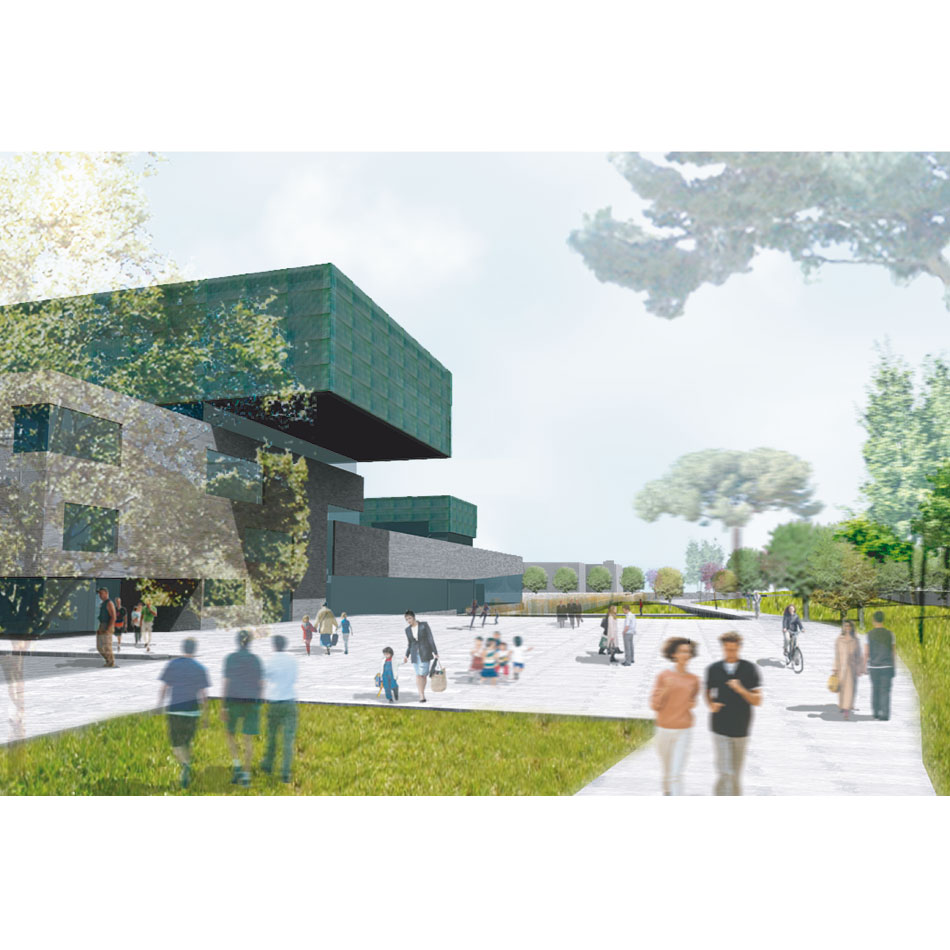
The site where will be built the cultural center “Città Alessandrina” is located is located along a road that joins the impressive remains of a Roman aqueduct and the Alessandrino Park. In the project of the cultural center and of the open spaces we chosen to interpret the site as the node that communicates with two different sizes: the size of the landscape to the north, towards Via dei Meli, and the urban size in south towards Via degli Olmi.
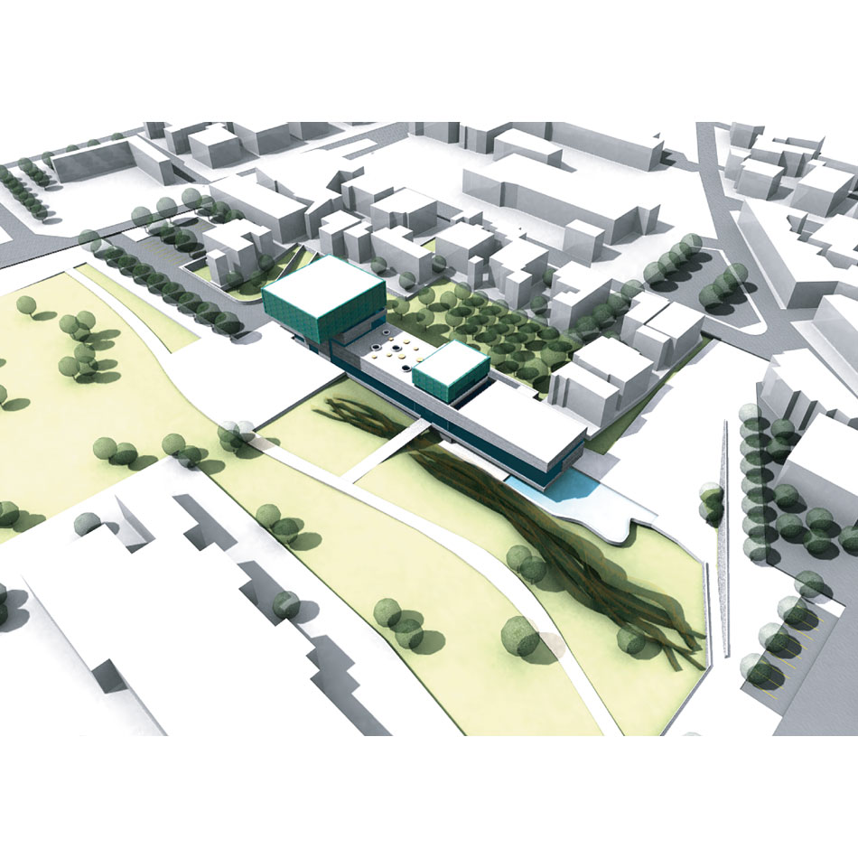
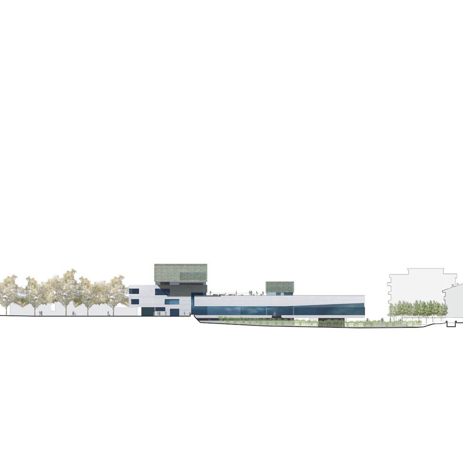
The new building, with its predominantly longitudinal system, it is as a node between the city and the park, a final element of an urban system that is easily accessible on foot, by bicycle or car. The original topography is maintained and the accesses to the cultural center are located, respectively, on north and south of the site.
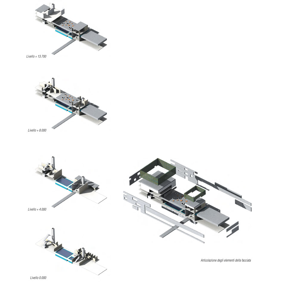
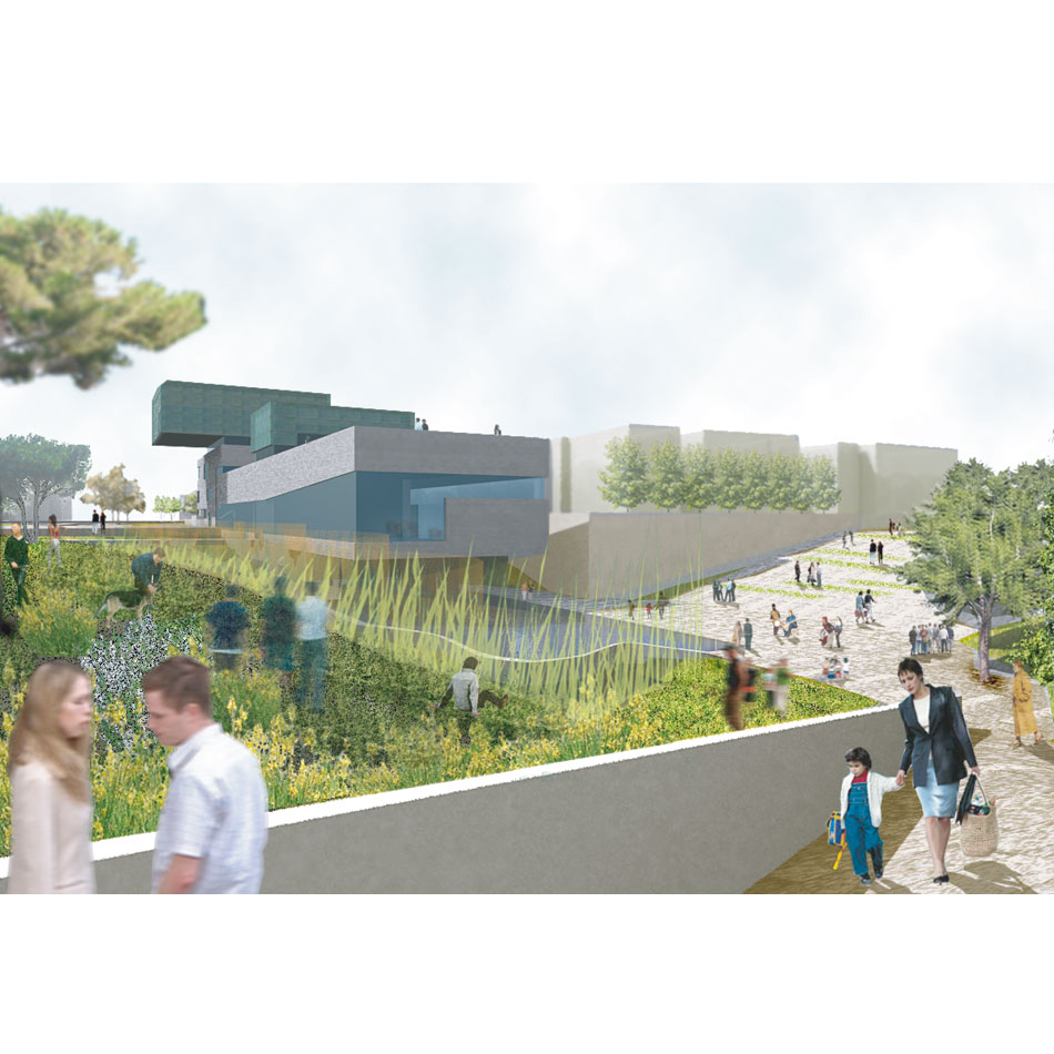
Via dei Meli is a winding path through the garden, characterized by the presence of a pre-existing reeds system and of terraces with shrubs that joins the cycle path, a large water tank and a terraced that can be used for performances. This path through the landscape leads to a lower level of the center where are the spaces for recreational activities and for the physiotherapy; an additional access to the sport areas is on the above level, through a bridge that with a raised path on the channel joins to the bicycle path.
…
Descrizione
II sito dove sorgerà il Centro culturale integrato Città Alessandrina è posto lungo una strada che costeggiagli imponenti resti dell’acquedotto romano ed il Parco Alessandrino con la cisterna idrica. Nel progetto del Centro e degli spazi aperti si è scelto di interpretare il sito come il nodo che dialoga con due differenti dimensioni: la dimensione del paesaggio a nord, verso Via dei Meli, e la dimensione urbana a sud, verso Via degli Olmi.
ll nuovo edificio, con il suo impianto prevalentemente longitudinale, è come un nodo tra la città e il parco, un elemento finale di un sistema urbano facilmente accessibile sia a piedi sia in bicicletta o in automobile. L’orografia originale è mantenuta e gli accessi all’area del Centro culturale sono posti, rispettivamente, a nord ed a sud del sito.
Da Via dei Meli si snoda un percorso che attraversa il giardino caratterizzato dalla presenza del canneto preesistente, dal sistema di terrazzamenti con arbusti che lambisce la pista ciclopedonale, da un’ampia vasca d’acqua e da una gradinata che potrà essere utilizzata per performances all’aperto. Attraverso questo percorso nel paesaggiosi accede alla quota inferiore del centro negli spazi destinati alle attività sportive e fisioterapiche, un ulteriore accesso agli spazi delle attività sportive è posto alla quota superiore attraversando un ponte che, con un percorso sopraelevato sul canale, giunge alla pista ciclo pedonale.
| PROJECT FACTS | |
| Location | Rome IT |
| Date | 2007 |
| Design team | Marco Scarpinato (Team leader), Giovanni Lucentini, Lucia Pierro, Carmelo Vitrano |
| CONSULTANTS | |
| Landscape consultant | Antonio Salvato |
| Client | City of Rome |
| Surface | 20.000 sm |
